Insurance
Aerial data for underwriting and claims: roof and facade condition, damage assessment, and property risk documentation.
We give insurers a faster, more reliable way to document property condition. SD Aerial covers roof, facade and structural checks in a single flight, replacing a ladder inspection or an outdated photo file. Damage is documented, risk is assessed, and property condition is verified without putting an adjuster on a roof.
Post-damage surveys are flown within hours of an event, so a claim gets documented while conditions are still fresh. Pre-policy surveys give underwriters current data instead of a self-reported form. Results are classified, geo-tagged and delivered as structured data, routed directly into the claims platform already in use.
Roof & facade condition
Roof and facade condition is hard to document accurately from the ground, and sending an adjuster up a ladder adds time, cost and risk to every inspection. A distant visual check also misses detail, so decisions often rest on incomplete information. SD Aerial surveys roofs and facades with RTK precision, capturing cracks, wear and water damage without anyone setting foot on the structure. Findings are classified and geo-tagged, delivered as structured data ready for the file, not photos to interpret.

Roof condition survey
A single RTK flight documents the full roof surface, capturing cracking and missing material a ground check can't match. The record is geo-tagged and timestamped, giving adjusters a defensible basis for a decision.
Facade & wall inspection
Facades and walls are surveyed for cracking and water ingress without scaffolding. Findings are mapped to the exact location, so repair estimates reference a specific point, not a general description.
Pre-policy risk survey
Roof condition, structural wear and nearby hazards are documented before a policy is issued or renewed, replacing a self-reported form with a current, RTK-accurate survey.
Damage assessment
After a storm, fire or another sudden event, the volume of properties needing inspection outpaces available adjusters, and every unassessed day adds pressure. A single flight documents roof and facade damage within hours, before repairs or weather change what's on site. Results are geo-tagged and delivered into the claims platform already in use, so an adjuster reviews documented findings instead of scheduling a visit weeks out.

Post-storm & post-incident documentation
Roof and facade damage from a storm, fire or other cause is documented within hours, before repairs begin. The geo-tagged, timestamped record gives adjusters a defensible basis without a physical site visit first.
Multi-property event mapping
Following a storm or another large-scale event, multiple properties across an area can be surveyed in one deployment, giving insurers a documented record across a portfolio instead of individual adjuster visits one property at a time.
Automated damage classification
Every flight is processed into classified, severity-ranked findings, giving adjusters a prioritised, repair-ready record instead of a folder of photos to sort through by hand.
Multi-property CAT response
Following a large-scale event, the number of properties needing inspection quickly outpaces available adjusters, and claims typically get worked in arrival order rather than by actual severity. SD Aerial surveys multiple properties across an affected area in a single deployment, giving insurers a documented condition record across the whole portfolio at once, so the most serious cases can be identified and prioritised first.
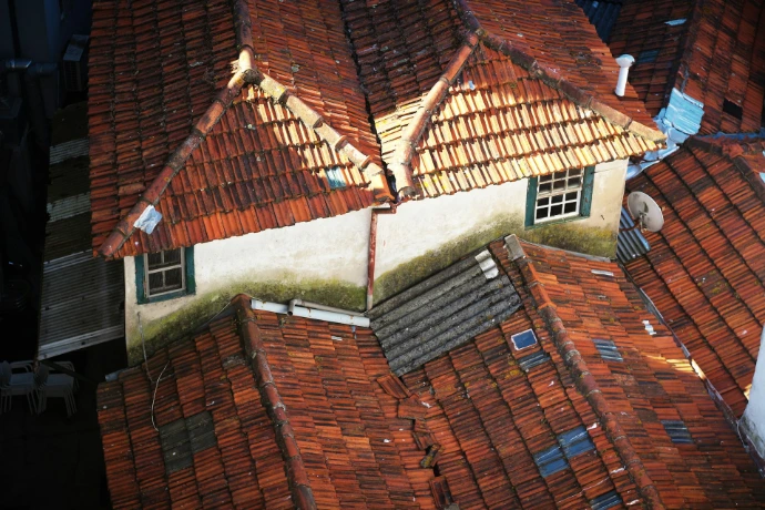
Post-disaster damage sweep
Properties across an area affected by a storm, flood or other natural event are surveyed in one deployment, giving insurers a documented condition record before repairs or further weather change what's on site.
Regulatory compliance sweep
A portfolio is surveyed to meet a compliance deadline, producing dated, geo-tagged records for every property ahead of an audit or reporting requirement.
Total loss identification
Severely damaged properties are flagged early in a sweep, so total-loss claims can be routed for fast settlement instead of waiting behind a full manual inspection queue.
Timestamped before/after evidence
When damage is reported, the question of whether it's new or pre-existing often comes down to a policyholder's account with no independent record to check it against. SD Aerial's dated, geo-tagged surveys create exactly that record, so a property's condition at any point in time can be confirmed rather than assumed. Comparing a current flight against an earlier one gives adjusters and underwriters documentation built to resolve a dispute, not just describe a property.
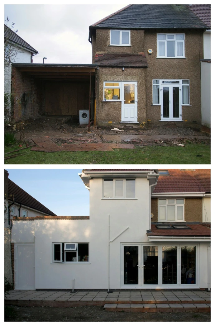
Pre-existing damage check
A before and after comparison confirms whether reported damage is new or was already present, using dated imagery from a prior survey. This helps resolve disputes without relying on a policyholder's account alone.
Dispute-ready documentation
Every survey is geo-tagged and timestamped at the moment of capture, producing a record that holds up in a coverage dispute or a fraud investigation, not just a general description of the property.
Why we're not just another drone company?
Faster turnaround
Findings are delivered within hours of a flight, not days after a manual audit and its written report.
Zero operational downtime
Flights are scheduled around live loading, unloading and vessel movements, so a survey never forces a pause in operations.
Direct system integration
Results are delivered straight into the WMS, ERP or GIS platform already in use, with no manual re-entry or separate report to file.
Full-site coverage in one flight
A single flight covers structural, thermal and volumetric checks across an entire site, replacing several separate manual walkthroughs.
Verified, audit-ready figures
Volumetric and condition data is accurate enough to support billing, inventory reporting and insurance claims.