Green Energy
Aerial data for solar farms and wind installations, covering panel-level thermal condition, blade and tower integrity, vegetation encroachment and portfolio-wide performance tracking.
Full-site thermal audits and panel-level defect detection replace manual walkthroughs and rope-access campaigns. Hotspots, failed diodes, PID degradation and cracked cells are flagged panel by panel, giving your team an exact location instead of a general area to search. Blade damage is classified by severity too, with each crack or erosion mark carrying its own urgency rating.
RTK-precision flights map every panel to the centimetre, so each finding points to one exact panel, not a rough estimate. Findings are classified, geo-tagged and delivered straight into your platform, ready to act on.
Solar Asset Management
Solar inspections across large portfolios are slow and hard to scale. SD Aerial combines RTK mapping, thermal imaging and high-resolution visuals to identify underperforming panels and pinpoint the exact issue. Every finding is linked to the right panel, string and location, giving your team clear data for faster maintenance and better yield protection.
Thermal audit at panel level
A ground-based thermal camera only covers one row at a time, so a full walk of a utility-scale site takes days and usually happens once or twice a year at most – leaving a hot cell or a failing bypass diode months to keep degrading before anyone notices the output drop.
Every panel is captured individually with RTK-geolocated thermal imaging in one site-wide flight, so a temperature anomaly is pinned to one exact panel and string, not flagged as "somewhere in this row.
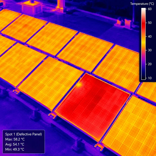
Full-site thermal survey
A complete thermal pass across the array, run ahead of peak generation season or on a recurring schedule, giving a baseline temperature reading for every panel on site.
Recurring seasonal audit
Scheduled thermal flights repeated at the same time each year build a comparable record, so a new hotspot or a worsening one stands out against last season's data.
Automated defect detection
Reviewing thermal footage frame by frame to spot a hotspot, a string outage or early PID degradation is slow and inconsistent — two people looking at the same footage can flag different things, and a subtle temperature anomaly is easy to miss across hours of raw video.
Thermal signatures are checked against known defect patterns automatically, so hotspots, string outages, PID degradation and diode failures are flagged the same way every time, with no footage left unreviewed.

Blade condition survey
Full-span imaging of every blade flags leading-edge erosion, cracks, delamination and lightning damage, geo-tagged to the exact section, supporting repair-versus-replace decisions instead of a general "needs attention" note.
Post-storm & lightning damage assessment
A rapid-response flight documents blade and tower condition within hours of a storm or a suspected lightning strike, before restart or repair, giving insurers and OEMs a timestamped, defensible record.
Optical condition audit
Soiling, shading and cracked glass rarely trigger an alarm on their own – they quietly reduce output panel by panel, and a routine walk-through only catches what's visible from ground level or from directly in front of a row.
High-resolution optical imagery captures every panel from directly overhead, so soiling patterns, shading sources and physical damage are identified and geo-tagged panel by panel, not estimated from a row-level glance.
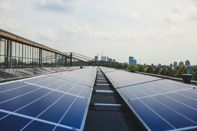
Soiling & shading assessment
Dust, dirt and shading from nearby structures or vegetation are mapped across the site and ranked by how much output each is costing, so cleaning and trimming get prioritised by impact.
Physical damage inspection
Cracked glass, delamination and frame damage are identified panel by panel, flagging what needs replacing now against what to monitor at the next inspection.
Wind Infrastructure & Commissioning
Wind turbine inspections need to be detailed, fast and practical. SD Aerial uses high-resolution drone imaging to inspect blades, towers and external infrastructure without routine rope-access work. Each defect is geo-tagged and rated by severity, helping teams decide what needs action now, what to monitor and what to schedule for maintenance.
Blade condition survey
Leading-edge erosion, cracks, delamination and lightning damage can reduce turbine efficiency and develop into costly repairs if left unresolved. From the ground, many of these defects are difficult or impossible to assess accurately.
Our drone blade inspections capture detailed imagery along the full blade span, including areas that are difficult to access manually. Findings are linked to the exact blade section and severity level, giving maintenance teams the detail needed to prioritise repair or replacement.
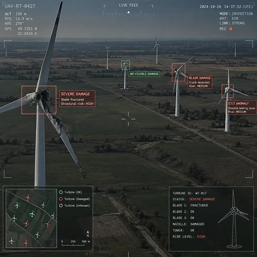
Blade damage assessment
Identify leading-edge erosion, cracks, delamination, surface damage and suspected lightning strikes across every blade.
Tower and nacelle visual inspection
Document visible external condition issues on towers, nacelles and associated infrastructure, supporting planned maintenance and condition records.
Post-storm and lightning damage assessment
Following severe weather, operators need a fast, defensible understanding of turbine condition before deciding on restart, repair or insurance action. Delays can extend downtime, while incomplete evidence can complicate claims.
SD Aerial mobilises quickly for drone-based wind turbine inspections after storms or suspected lightning strikes. We provide timestamped imagery and structured findings that support technical reviews, insurance documentation and repair planning.
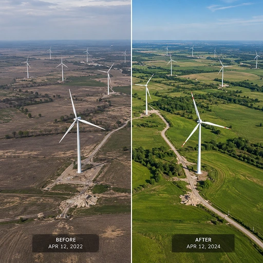
Rapid-response storm survey
Assess external blade and tower condition quickly after severe weather, reducing uncertainty around the next operational step.
Insurance and warranty evidence
Deliver clear, geo-tagged visual records to support conversations with insurers, OEMs and repair providers.
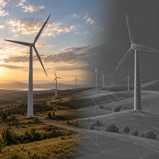
Wind farm commissioning documentation
A robust commissioning record gives operators a clear baseline from day one. It also helps distinguish installation or delivery issues from defects that develop later in operation.
Our drone surveys document turbine, blade and surrounding infrastructure condition before final handover. The data is organised for straightforward review, reporting and integration into your asset-management workflow.
Pre-handover visual inspection
Record the external condition of blades, towers and site infrastructure before acceptance, helping identify visible issues while responsibility remains with the relevant contractor.
Baseline asset documentation
Establish a consistent, geo-tagged condition record for future inspections, warranty tracking and maintenance planning.
Why we're not just another drone company?
Traditional methods
High cost
Slow deployment
Safety risk to people
Standard drone operators
Raw photo and video files
No system integration
Manual data entry for your team
SD Aerial Survey-grade
RTK precision
Direct ERP / dashboard integration
Zero manual work, fully turnkey